Was das Museum bietet
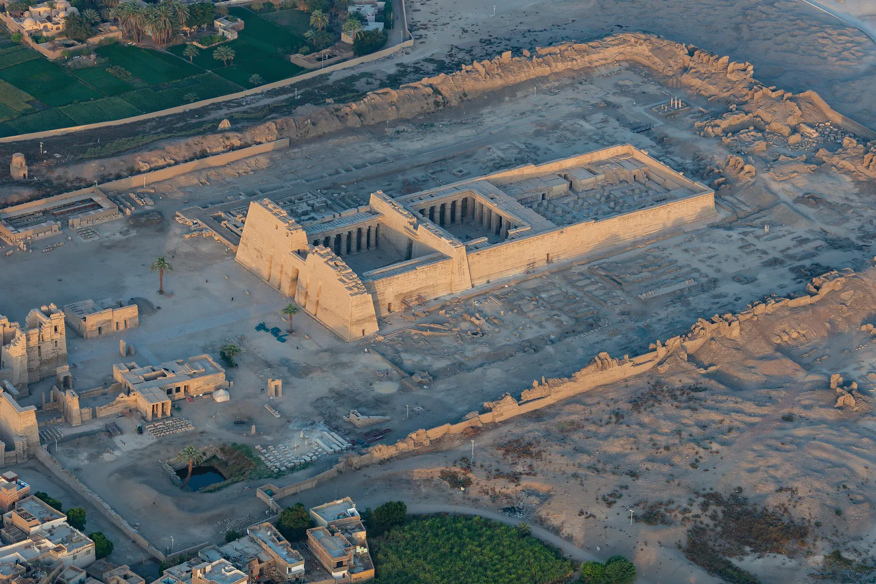
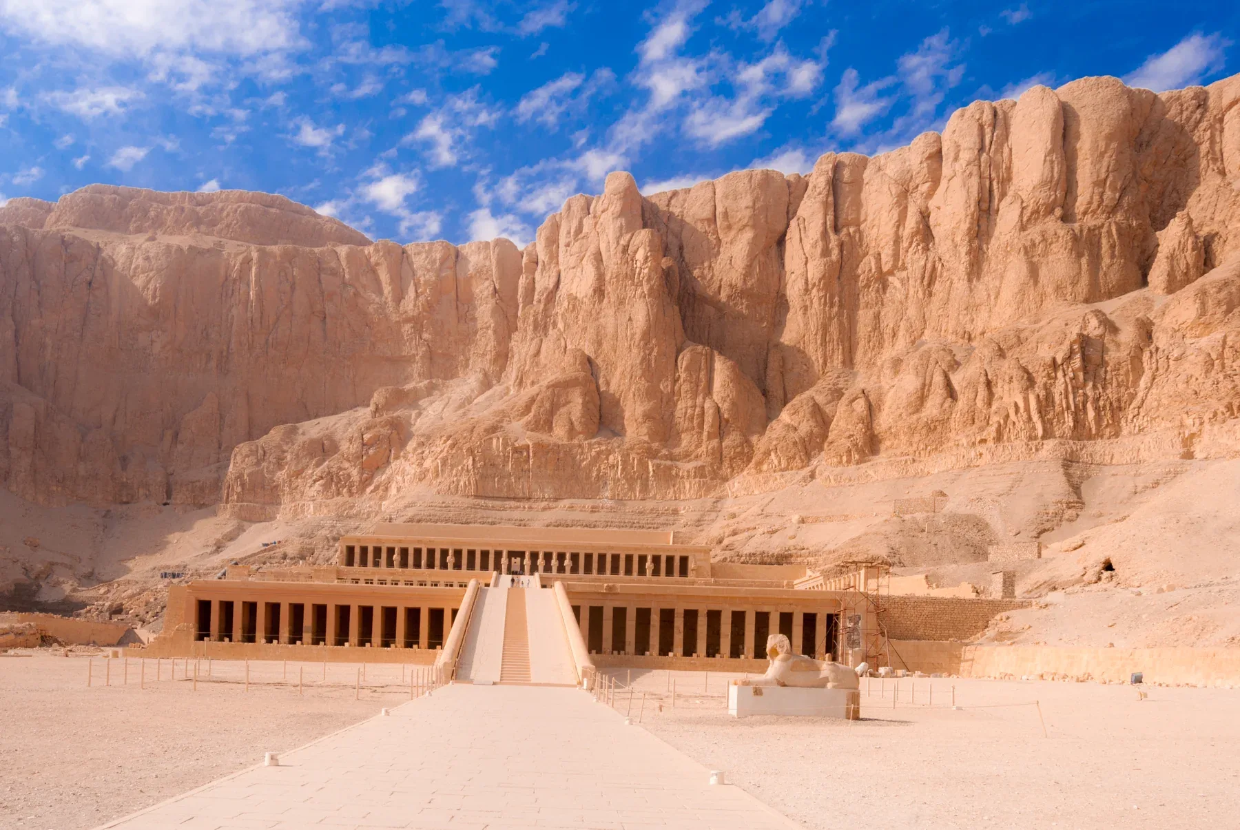
The temple Hatshepsut built against the cliffs of Deir al-Bahari on the west bank at Thebes, directly across the river from Karnak. The Egyptians called it Djeser-djeseru, rendered "the Holy of Holies" by the official listing and "sacred of sacreds" by Richard H. Wilkinson. It rises in terraces of courts and colonnades linked by ramps, with its innermost sanctuary cut into the rock.
It is called a mortuary temple, but Barry Kemp points out that temples like this were in reality dedicated to a specific form of the god Amun, with whom the king became fused in death. At Deir el-Bahri that god was Amun "Holy of Holies".
History
Hatshepsut was the daughter of Thutmose I and the wife of Thutmose II, whom she outlived. She first acted as regent for the young Thutmose III, then had herself proclaimed king and ruled as the dominant partner, c. 1473–1458 BC. In her temple she appears throughout as the rightful king, depicted and often referred to as male; Kemp notes that the conventions of kingship left no other choice.
Who designed it is recorded in more than one way. The official listing names Senenmut, chief steward of Amun, as designer. Betsy Bryan notes that the funerary inscriptions of Senenmut and of the treasurer Djehuty both suggest they were active in building and embellishing the temple. Blocks from its now-destroyed valley temple carry a different name, the architect Puimre, written on their undersides. How long it took is also given differently: Richard H. Wilkinson says fifteen years, Toby Wilkinson thirteen.
The site had its own meaning before her. The bay of Deir el-Bahri was long associated with the goddess Hathor, and Hatshepsut's temple drew on the terraced temple of the Middle Kingdom king Mentuhotep beside it. Once a year, at the Beautiful Feast of the Valley, the image of Amun crossed from Karnak to Deir el-Bahri, and the temple's sanctuary received the god's sacred boat.
The walls tell the story she wanted told. In the lower and middle colonnades are the transport of her obelisks to Karnak, a Nubian campaign, her divine birth with Amun named as her true father, and the expedition to Punt, a land reached by the Red Sea whose exact location is still debated. Emily Teeter notes that Hatshepsut claimed Amun himself directed her to Punt.
After her reign the temple was damaged many times. Her kingly names and images were attacked in the final years of Thutmose III's reign and the work was completed under Amenhotep II. Bryan and Colleen Manassa Darnell both argue this was unlikely to be personal vengeance; Darnell suggests it strengthened Amenhotep II's succession. Under Akhenaten many images of Amun were destroyed; Seti I later restored the temple. In the Ptolemaic period the sanctuary was renewed to include the cults of Imhotep and Amenhotep son of Hapu. By the seventh century AD a Coptic monastery stood in the temple, and its early monks defaced many images of the gods.
The temple was little more than a ruin when Édouard Naville excavated it in the 1890s. Since 1961 a Polish–Egyptian mission has worked there and carried out a great deal of reconstruction.
What you actually see
The approach rises through three broad courts, separated by colonnades and linked by ramps. Hatshepsut recorded that she built the temple as "a garden for my father Amun", and the first court once held trees brought from Punt.
In the colonnade of the middle terrace, look for the Punt reliefs on the south side and the birth scenes on the north. At the southern end of that colonnade is a chapel of Hathor with Hathor-headed columns; at the northern end, a smaller chapel of Anubis.
On the upper terrace, the portico once had Osiride statues of the queen in front of every pillar, though most have been destroyed. Behind it, a columned court leads to chapels for the royal cult and the solar cult, and to the sanctuary of Amun cut into the cliff face.
Practical
- Open 06:00-17:00 daily, per the Ministry listing read on 2026-09-14.
Eintritt und Öffnungszeiten
- Eintritt für ausländische Erwachsene
- EGP 440. Studierende zahlen die Hälfte.
- Öffnungszeiten
- 06:00–17:00, laut .
- Quelle
- der Seite des Ministeriums für Tourismus und Altertümer zu Hatschepsut-Tempel, abgerufen am . Preise können sich ändern; maßgeblich ist die Ministeriumsseite. Alle Stätten in einer Tabelle: Eintrittspreise und Öffnungszeiten ägyptischer Stätten.
Eintritt, Öffnungszeiten und Planungstipps
- Eintrittskarten für das Tal der Könige
- Offizielle Preise, empfehlenswerte Gräber und die beste Besuchszeit.
- Eintrittskarten und Öffnungszeiten der Stätten
- 15 bedeutende Stätten in einer datierten Tabelle.
- Von Kairo nach Luxor
- Flug, Schlafwagen, Tageszug oder Straße mit Zeiten und Preisen.
- Von Luxor nach Assuan
- Kreuzfahrt, Zug oder Straße über Edfu und Kom Ombo im Vergleich.